The RV Gang

The  RV  Gang

Saturday, September 22, 2012

May, 30th: TAHOE, CALIFORNIA


May 30th:

We have been around the U.S. in 75 days and hard to believe that we are back in California.  Of all the beautiful country that we have seen all over America there is nothing like Lake Tahoe.  I can easily say now that I have traveled the US, that it is my favorite place, besides Maui,, in America.     The smell of the fresh mountain air, the beauty of the mountains with snow, and the sun reflecting off the clear blue lake is a little slice of heaven. 

Today was a perfect day of relaxation on the beach by the lake.  The kids were thrilled to play in the water, catch crawdads, swim, and build a sand fort for their crawdads to live in.   Shelley and I spent the day at the breath-taking beach trying to catch up on our Blogs and just relaxing.  It was absolutely beautiful and I don’t want to go home back to the rat race of life.  .   I’m trying really hard not to be sad about the trip being over, but to be thankful for all that we have accomplished. 

We thouroughly enjoyed our time at Tahoe with the conclusion that after traveling across the country that it is truly the most beautiful place in America!  We so easily take it for granted because it is so close to us, but I don't think I ever will again!


It’s been a wonderful, amazing, adventurous, educational, renewing, crazy and perfect provided trip by God. We will remember it for the rest of our lives. Thank you Lord for your “good and perfect gifts”!! 

May 29th: PROMONTORY POINT & SALT FLATS, UTAH to LAKE TAHOE, CALIFORNIA

May 29th:

We got up early this morning and drove 30 minutes to Promontory National memorial park and arrived right when it opened.   It felt great to be on time for once!  Too bad it’s the end of the trip and we finally are on time!  Ha!  I know we’ve been on time a few places but it feels like we’ve been running behind the whole trip.  Good for us!

Because we were on time, we had time to stroll through the museum and gift shop before the working replicas of Jupiter and No. 119 arrived.  And of course we had the kids do their last Junior Ranger book of the trip.  We cheered them on while we told them to make the most of this last opportunity to do the Junior Ranger program.  They now have a collection of 19 Junior Ranger badges as keepsakes of what they learned at all the National Parks. 
This last National Park is all about the “Golden Spike,” which is what tied the east and the west together. 
Railroads began operating in the 1830’s and by the beginning of the Civil War, America’s eastern states were linked by 31,000 miles of rail, more than in all of Europe.  Unfortunately all of this network was in the east and didn’t reach beyond the Missouri River.  Many Northern, Midwestern and Southern senators fought for a railroad that would bring many benefits of trade, shorten western journeys, and help the army control American Indians resisting white settlements.  In California, Theodore Judah, a young engineer, had his own plan for a transcontinental railroad.  By 1862 Judah had surveyed a route over the Sierra Nevada’s and persuaded wealthy Sacramento merchants, Leland Stanford, Collis Huntington, Charles Crocker, and Mark Hopkins – “The big Four” - to form the Central Pacific Railroad.  That same year Congress authorized Central Pacific to build a railroad eastward from Sacramento and in the same act chartered the Union Pacific Railroad in New York with each railroad receiving $16,000 to $48,000 per mile, depending the difficulty of the terrain.    The Central Pacific broke ground in January of 1863 and the Union Pacific that December, but neither one made any headway because the country’s attention was on the Civil War, and little track was laid until labor and supplies were freed at the end of the war.
 
Central Pacific crews were challenged with rugged Sierra Nevada range immediately, while the Union Pacific built on easier terrain starting in Omaha, Nebraska.   Getting supplies to both railroads was a nightmare, especially for the Central Pacific, which had to ship every rail, spike, and locomotive 15,000 miles around the Cape Horn.  Although, both pushed ahead faster than anyone had expected laying 2-5 miles of track a day on flat land.  The Union Pacific hired many unemployed immigrants – Irish, German, and Italian, and Civil War veterans from both sides, ex-slaves, and even Indians.  The Central Pacific hired several thousand Chinese because the rush for gold and the silver boom had drained California’s labor pool. 
By mid-1868 Central Pacific crews had crossed the Sierra and laid 200 miles of track and the Union Pacific had laid 700 miles over the plains.    Surveyors worked hundreds of miles ahead, while scrapers, and graders prepared about 20 miles of bed at a time, cutting ledges, blasting hills, and filling all ravines.  Workers 5-20 miles ahead dug tunnels and built high wooden trestles – the Central Pacific blasted 15 tunnels through Sierra granite using dangerous nitroglycerine.  As the two railroads traveled closer to meeting they raced to gain more miles and claim more land subsidies. Congress finally declared the meeting place to be Promontory Point, Utah, and On May 10th, 1869, two locomotive – Central Pacific’s Jupiter and Union Pacific’s No. 119 – pulled up to the one-rail gap left in the track.  After a golden spike was symbolically tapped, a final spike was driven to connect the railroads.  Central Pacific had laid 690 miles of track, and Union Pacific 1,086, crossing 1,776 miles of desert, rivers and mountains to bind together East and West.  Engraved on the Golden Spike is “May God continue the unity of our Country as this Railroad unites the two great Oceans of the World.”  That’s awesome!  The Golden Spike is now displayed at Stanford University in their museum. 
At 10:00am we stood outside the museum, next to the railroad tracks, to wait for the Union Pacific’s replica, the No. 119, to arrive.  Far away we heard the noise and steam of the engine, and the toot of the whistle, as it slowly came towards us.  It was fascinating and such a treat


At noon we got back on the road towards California.  We had to drive back through Salt Lake City to connect with the 80 freeway west– the 80 that travels through Tahoe and Sacramento to highway 12.  We will travel on this road all the way home through 3 states.  The 80 extends all the way across the northern part of the USA just like the 10 freeway in the southern US.  As we drove along we came to the famous Booneville Salt Flats of Utah right off the 80 and we pulled over to walk on it.  It was absolutely amazing.  When you look into the horizon the glare makes it look like it goes on forever and mixed with the white it can seem like water. 

We still had 6 more hours of driving through ugly Nevada, on to beautiful Lake Tahoe.  It felt like the longest drive ever . . . nothing to see and we are all ready to get home.  We worked for hours with the kids on their books and finishing all the fun facts about each state.  They worked diligently and finished them all – they were very proud!   We still have a huge amount of work to do on their books but we accomplished an enormous amount on the trip.  Hopefully it will be something that they remember forever.

We arrived at Sweet Briar in Kings Beach, Lake Tahoe at 1 am.  The parking lot had cars spread out but there was a nice small corner to park the RV in but it was extremely difficult and took us about a half hour.    But Shelley and I can do anything now after driving the RV all the way across the country and parking it in many different places.  After parking I finally stepped out of the RV and felt a huge sigh or relief . . . “We’re home!”  Tahoe is like a second home to me and there is nothing like the smell of Tahoe . . . the fresh crisp air, the pine trees, the stars . . . it’s so incredibly beautiful   It made me feel incredibly thankful that I live here and that we actually made it home to California!!


May 28th: SALT LAKE CITY, UTAH


May 28th:

We packed up this morning and drove back to Arches National Park so that the kids could get their Junior Ranger badges.  The lady went over everything in detail and was especially detailed about the millions of years.  The kids asked her all kinds of questions about the millions of years in relation to the Bible and the flood of Noah, but she didn’t clue in at all and kept rambling on about all the rock formations “millions of years ago."   The kids were frustrated that she didn't listen but I told them that they planted a seed of thought in her heart and who knows what God will do with it.   It's hard to impact many of the people who don't know anything else except evolution, and they have no desire to listen or read anything.  They are stubborn and their hearts are hard.


Onward to Salt Lake City, again through the land of nothingness!  I’m telling you that the southern end of Colorado and Utah are ugly!!   


We drove for 3 hours of plain terrain, and then suddenly there were mountains . . . even mountains with snow.  I was strange that the terrain changed so quickly.  It actually became beautiful, with mountains, streams, and a cliff-side train track.   Although, I knew we were still in barren land when we drove past the biggest wind powered generators that I have ever seen.  
Finally we arrived in Salt Lake City and drove downtown.  We were curious to see  the Mormon temple and square.   I had no idea that it was actually the whole downtown.  We drove down the main street and pulled over to the sidewalk.  All around us were “Latter Day Saints” buildings and the main tabernacle.  I actually felt chills go up my spine and thought, “should I really be here?”  Then I decided that we needed to pray for the Lords protection and wisdom as we walked around the area. 
The Salt Lake Temple is the centerpiece of the 10-acre Temple Square in the downtown Salt Lake City.  The temple grounds are open to the public but the temple is considered sacred and a “temple recommend” is required to enter, so there is no public tours.   

But there was a visitors center that we decided to go into . . . it was a large building full of displays about the building of the temple, the traditions, a model of the temple, and a computer display about the levels of the temple and what they are used for.  We started reading about the baptismal bottom level of the temple and we decided that we needed to leave . . . we all felt a little strange about being there and ran out to the center square.  We took some pictures and then we left.  It was good for all of us the see the area and educate the kids a little on Mormonism, but glad it was short.   

Next we drove to the nearest Starbucks to collect our “Utah” mug and it was in a beautiful outdoor mall.   They named the mall the “Olympic Plaza” and was built for the 2002 winter Olympics.  We found our mugs, shopped a little, and then we were off to Promontory Point, Utah, about an hour and 20 minutes away, to spend the night.    On the way we drove under several overpasses that had different Olympic athletic emblems on the sides . . . it was very exciting to see!   We tried to get pictures of them all but  most came too fast and we missed them!    

Finally we arrived at our State park camp ground, made dinner and went to bed.  It’s hard to believe that we are almost home!  Three more days!


Tuesday, July 17, 2012

May 27th: ARCHES NATIONAL PARK, UTAH

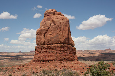
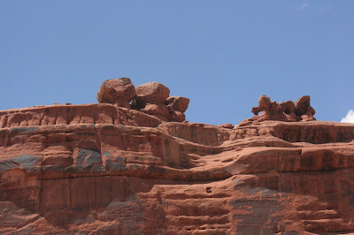
When we woke up this morning and stepped out of the RV, I was right, the rock is huge and beautiful.  It is a reddish color with streaks of lighter and darker colors.  Beautiful!! Since it’s Sunday we had a wonderful devotion, prayer time, and worship as we sat outside looking at the beautiful surroundings.

We drove to Arches National Park just 3 miles down the road and the rocks became more vibrant and breathtaking.

After entering the gate, we parked in the visitor center parking lot and went inside to see the museum and the movie.  Of course, the national park system states that it was millions of years ago that the rocks were formed in everything that they write or spoke in the movie.    How in the world do they know that???  If they don’t have any written history or documentation from millions of years ago, how can they say with such confidence that it is millions of years ago??  And all of the millions of years are different.  In the visitor center it said 50 million years ago; in the movie it said 25 million years ago; and in the brochure it says 100 million years ago!!   For heavens sake, just get with God people!!
The Arches brochure explains that water and ice, extreme temperatures, and underground salt movement are responsible for the sculptured rock scenery of Arches National Park.   We know from the Bible that there was the great flood and within 40 days the earth was covered in water.     The flood completely explains that the violent rushing of water mixed with underground salt movement, ice, and extreme temperature created this beautiful area with the world’s greatest densities of natural arches.   It seems so obvious to me and confirms Romans 1:20 where is says, “For since the creation of the world God’s invisible qualities – his eternal power and divine nature – have been clearly seen, being understood from what has been made, so that people are without excuse.”  When you see beauty and amazing land formations such as these arches, there is no excuse not to believe in a Creator. 


There are over 2,000 arches in the park ranging in size from a 3 feet opening to the longest, Landscape arch, measuring 306 feet from base to base.  In 1991, a rock slab 60 feet long, 11 feet wide, and four feet thick fell from the underside of Landscape Arch, leaving a thinner ribbon of rock.   Delicate Arch, is an isolated remnant of a bygone fin, and stand on the brink of a canyon.     Towering spires, pinnacles, and balanced rocks are perched on top of what seems like an inadequate base but are rare beautiful rock formations. 


We had a wonderful day driving through the entire National Park and hiking through some of the canyons to view the beautiful arches.  We watched the sunset from the Double  O Arch,  which was spectacular.   Amazing that in the middle of the dessert  of Utah beautiful, creative rock formations pop up out of nowhere.  Only God could do that!!


May 26th: DURANGO, MESA VERDE, FOUR CORNERS COLORADO & UTAH

Yummy, another KOA that makes a lovely pancake breakfast for the kids to eat!!  They absolutely love it because we don’t have time to make pancake and they had all you can eat this morning.    
Because we were too late getting in last night we wanted to stop in the town of Durango on our way to Mesa Verde National Park.     I had heard that it was very quaint town, and whoever told me that was right.  The Denver and Rio Grande Railroad organized the town in 1881 and it became an old mining town with the oldest working steam locomotive in the United States.  The train was used for mining silver out of the mountains and became known as the Durango & Silverton Narrow Gauge Railroad.  The elevation is 6512 feet. 
We went to the adorable little train museum that had some of the original Rio Grande steam engines.  And it had the biggest model train town that I have ever seen.    It was a great little museum and even better, it was free.


Downtown Durango had many adorable little gift shops.  It reminded me of downtown Truckee but a little bigger.  The girls wanted to go into the silver jewelry shop where we all got “hooked in” and loved all of the beautiful silver jewelry.   I got 3 necklace pendants, Brooke got a ring, and Brittany got a necklace.  It was a fun way to remember the beautiful little town. 
Next we drove to Mesa Verde National Park which is Anasazi cliff dwellings.  To get to the actual cliff dwellings it is a 20 mile drive up the mountains and cliffs.  Unfortunately there has been some fires in New Mexico and Arizona, and because of the winds coming towards us, the views from the mountains were awful.  The visibility was poor, and the wind gusts were blowing at about 40 miles per hour.    Yuck, I hate this kind of weather. 


Mesa Verde National Park is the preservation of the ancient cliff dwelling of the Anasazi people which comes from a Navajo work meaning “the ancient foreigners”.  Now they are called the Ancestral Puebloans.    It was in the 1880’s that a local cowboy reported the cliff dwellings, and many archeologists since have sought to understand these people’s lives.    About 1400 years ago a group of people lived in the Mesa Verde area building homes that show amazing skills and traditions that were passed down from generation to generation.    Using the cliffs to their advantage, the Anasazi built their homes beneath overhanging cliffs.  Their basic construction material was sandstone that they shaped into rectangular blocks about the size of a loaf of bread.  The mortar between the blocks was a mix of dirt and water.  Living rooms averaged about 6 feet by eight feet, space enough for 2-3 persons.  Other rooms were used for storing crops and cooking.  Farming corn, beans, and squash was their main work, but they also gathered plants and hunted deer, rabbits, squirrels, and other game.  Their domestic animals were turkeys and dogs.
We walked down to the Spruce Tree House which is exactly what it would have looked like when it was discovered.   This is one of the largest villages in Mesa Verde with 129 rooms and eight kivas (or gathering rooms).  About 60-90 natives lived there at one time.  Several  families probably lived in rooms together and maybe each clan would have it’s own kiva and rights to their own agricultural plots.   Archeology has given some information about their lives but without written records their social, political, or religious ideas are really unknown, but some information has been gathered from the modern Pueblo people of New Mexico and Arizona.   It was fascinating to see, but honestly not one of my favorite stops. 


After leaving Mesa Verde we drove through the “Valley of Death and Nothingness” along the south west end of Colorado to the four corners of Colorado, Arizona, New Mexico, and Utah.   It was out in the middle of NO WHERE LAND!    And I thought Kansas was in the middle of nowhere . . . this area is actually worse.  The land is dry as a bone with only rocks and dirt, no bushes or trees anywhere.  Finally, there was a sign for the 4 Corners and we turned onto a long dirt road ending with a booth with an Indian lady collecting $3 a person cash.  Ha, of course the Indian reservation would collect money to see a plaque on the ground AND only cash.   But then again, I would too if I was given land like this – isn’t our government nice to Indians giving the ugliest land in America?   Well, unfortunately, we didn’t have quite enough cash . . . the kids started grabbing change from wherever they could and thankfully we mustered up enough change for $18  and she let us in (good thing we didn’t come all the way out here for nothing).    The parking lot was dirt and the monument was a cement slab square where the borders of the states are marked on the ground with plaques and dividers.  Around the outside of the monument were outside rooms for all the Indian venders trying to sell something to the “white man”.   Most of them were gone by the time we got there, but there were a couple of Indians selling jewelry.

We got down on the plaque and played “Twister” to try and touch all four states all together.  We all had a great time falling over and laughing in the process, so it made it all worth it to come see the 4 Corners.


We left after taking about 100 pictures of different positions and drove again into “Nowhere Land” for about 2 hours.  Although, I have to say that the sunsets are amazing out in this open range because there is nothing to block the view.  And we also saw some wild horses . . . yes, wild horses.  There was no fenced in area and no ranch around so they had to be wild.  We passed them and then I realized that they were wild.  We turned around to try and take some pictures but they were too fast and ran off.  They were beautiful and we were all amazed!!

When we arrived at the campground  tonight I noticed how bright the stars were outside . . . beautiful.  And all I could see in front of me, behind the camper, was a big black wall.  I wondered if  that was part of the large rocks that we might see at Arches!!